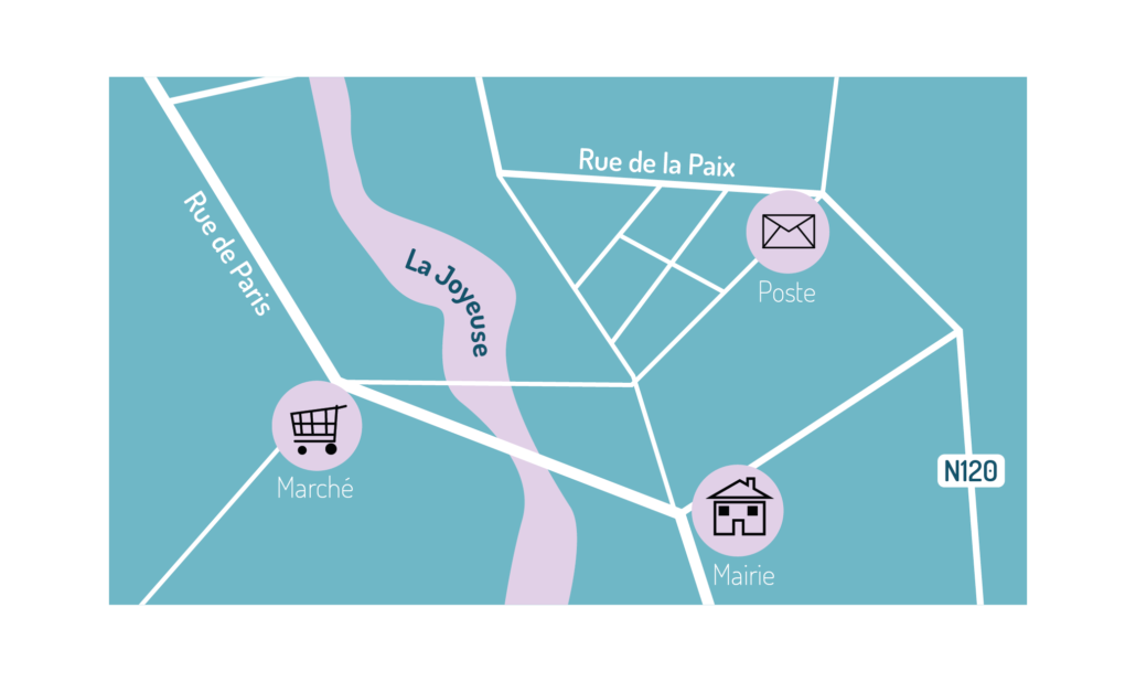
Create your own map data in interactive mode

Use a comprehensive and powerful set of drawing and editing tools

Take advantage of a full featured, highly accurate drawing engine

The comprehensive drawing engine is designed to build and update your data, and enables to create a whole cartographic database with the highest accuracy. Attributes and Data are managed in an open format.

Work Environment

By combining the performance of all tools and cartographic data creation modules, you can as well work from a blank workplane or from existing files. It is also possible to combine several files or sources processed by LorikSoftware but also from GIS databases as all workplanes are georeferenced and provide optimal combination options.
  • Georeferenced working environment
  • Multi-user access
  • Display mode options: wireframe, color, film, anti-aliasing, WYSIWYG etc…
  • Import of raster data files, WMS, ECWP
  • Layers and views for handling multiple contents
Create very large databases managed with multi-user access.

Drawing and digitizing

The drawing tools associated with the georeferencing of the workplane enable the creation of spatial data using ultra-customized and detailed styles for the creation or digitization of your maps:
  • Bézier curves with automatic discretization for data storage in DIGEST
  • Snapping option for the creation of segments (automatic creation of points at junctions)
  • Smoothing of curves
  • Simplification of curves, creation of rounded corners
  • Creation of parallels and surfaces from linear objects
  • Creation and management of holes
  • Object modification: rotation, mirror and size modification
  • Accurate and geo-referenced translation or positioning of objects
  • Use of background images (including remote ones, e.g. WMS) to sketch or update your data
Be able to use powerful geometric tools to create and modify your data.

Text features

The editing tools are also extended by text input options with specific properties intended for cartography such as flat text, text associated with curves etc…
  • Text insertion on curves, at an insertion point or in blocks
  • Interactive editing with keyboard shortcuts (Up/Down a line, spacing, size, alternative font, etc.)
  • Export/import of texts for editing or translation
  • Management of multi-language texts
  • Import of text lists
Use a powerful text editing engine dedicated to designing maps in any language.

Attributes

To complement your data and make it usable in the most efficient way, the direct creation of cartographic data also allows you to add information for each object in the form of attributes managed and available throughout the creation and production chain of your maps.
  • Text attribute management for each object
  • Internal or external storage
  • External tables connection
  • Default values
  • Automatic system attributes
Create maps and databases at the same time. Manage multiple sets of attributes and share your data with other programs.

Sample of direct map data creation and map navigation tools

Drawing tools

Overview of some tools

Bezier curves

Rectangle

Circle

Free curves

Symbol deposit

Text and Elevation spot placement tools

Overview of some tools

Flat text

Block extended text

Text on curve

Flat text on curve

Elevation spot

Georeferenced tools

Overview of some tools

Georeferencing tool

Add a “named point”

Go to a specific position

Measure tool

Go to a named point

Alignment tools

Overview of some tools

Vertical alignment (center)

Vertical alignment (bottom)

Horizontal alignment (right)

Horizontal alignment (left)

Horizontal alignment (center)

And many other tools…